From forecasting to real-time alerting to post-disaster response, here’s how we’re collaborating with the UN, governments and international organizations on global crisis resilience.
Forecasting and preparing for hazards
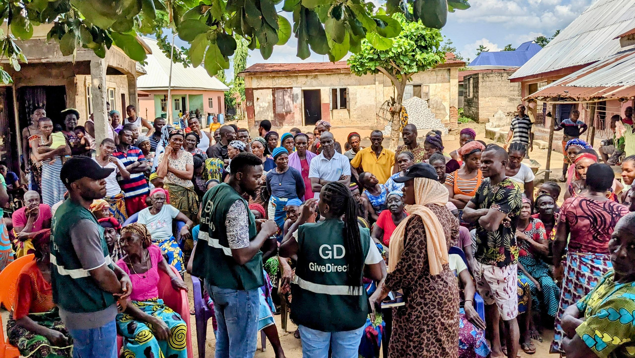
Timely nowcasts and forecasts enable governments, humanitarian organizations and communities to take action before disasters strike. During the 2025 hurricane season, the U.S. National Hurricane Center used Google’s WeatherNext model. It predicted Hurricane Melissa’s historic Jamaican landfall five days in advance, enabling the Met Service in Jamaica to notify the public. In Nigeria’s Adamawa state, UN OCHA launched a Floods Anticipatory Action Programme using Google’s river flood forecasts. When forecasts indicate a high risk of significant flooding, it activates a set of early interventions such as shelter preparation. The NGO GiveDirectly employed a similar approach in Nigeria’s Kogi State, using Google’s forecasts to deliver cash transfers before flooding. This enabled families to evacuate safely and purchase equipment like sandbags to protect their property.
Our forecasts are available on Flood Hub, covering 2 billion people across more than 150 countries, in areas at risk for significant flood events. We’re continuously improving forecasting capabilities together with our partners. The World Meteorological Organization (WMO) and national hydrological agencies in Czechia, Nigeria, Uruguay and Vietnam launched a pilot with Google to evaluate how local data affects AI forecasting in regional river basins. We found that incorporating local streamflow data into global AI models significantly improves forecasts in ungauged areas. The results of the study, to be published in the coming weeks, highlight the value of combining global AI models with localized expertise, offering a blueprint for how AI can better support national forecasting efforts.
To further advance research, we recently open-sourced our Groundsource dataset for urban flash floods, and our hydrology modeling framework, helping experts build new approaches while retaining full control of their own local data. We tested the hydrology framework with the Czech Hydrometeorological Institute (CHMI), who developed an adapter enabling them and other hydrological services worldwide to use the model in their standard workflows.
For wildfires, we leverage satellite imagery to track fire boundaries in Search and Maps, with coverage in 34 countries. In collaboration with the Earth Fire Alliance and Muon Space, we developed the purpose-built FireSat constellation, which aims to provide an unprecedented, wildfire dataset and help fire agencies detect wildfires more quickly before they spread, anywhere on earth. Earlier today, three new FireSat satellites launched from Vandenberg Space Force Base in California.
Providing life-saving alerts in times of crisis
In times of crisis, access to reliable, authoritative information is critical for those affected. In 2025 alone, Google helped connect people with crisis information over 10 million times per day, on average.
Among the alerts we distribute are Public Alerts — surfacing content from alerting authorities through Common Alerting Protocol (CAP) feeds. These Public Alerts feature data from authorities in over 90 countries so far, from partners like the US National Weather Service, the UK’s Met Office and Brazil’s Centro Nacional de Gerenciamento de Riscos e Desastres (CENAD). We encourage more nations to publish CAP alert feeds.
When authorities issue these alerts, they can appear across Search, Maps and as Android notifications. This ensures that public safety information, such as severe weather warnings and flood updates, and the practical information people need to stay safe, reaches people quickly and directly.
While warning people effectively about earthquakes remains a critical challenge, we have made progress in alerting those outside the epicenter. When devastating earthquakes hit Venezuela last month, Google’s Android Earthquake alerting system, leveraging a network of Android phones as mini-seismometers, alerted millions of users outside the epicenter enabling them to take cover seconds before the shaking began.
Using satellite imagery to accelerate disaster response
Post-disaster, the core challenge is getting life-saving aid to the people who need it as quickly as possible. AI-powered insights can help governments and organizations respond more efficiently.
Data Insights for Social and Humanitarian Action (DISHA) developed a damage assessment workflow in collaboration with Google, implemented in collaboration with the UN Satellite Centre (UNOSAT). It uses Open Buildings and Building Damage Assessment models to analyze satellite imagery, and was recently enhanced with a new interface, marking a new phase of operational impact. To date, it has been deployed 11 times, supporting the response to disasters like earthquakes, floods and cyclones. It enables high-precision analysis of hundreds of thousands of buildings in very short timeframes, saving UNOSAT specialists weeks of work per activation.
When Hurricane Melissa devastated Jamaica in October 2025, this AI-based analysis assigned preliminary damage scores to over 385,000 buildings to inform recovery efforts. More recently, following the February 2026 floods in Colombia, UNOSAT rapidly assessed damaged infrastructure by cross-referencing AI-derived building maps with radar imagery of the flooding. The analysis informed the response planning of UN humanitarian agencies and the national government.